The Galapagos Islands aren’t just full of wildlife – they’re also full of geology. They are located above a hotspot in the earth’s crust that has been active for at least 20 million years. The very oldest islands in the group were likely formed between 8 and 10 million years ago, but have have eroded beneath the waves as the Nazca Plate they sit on slowly slides East/Southeast towards the South American mainland at a rate of about 6cm per year. Of the islands that are currently visible, Isla Espanola is the oldest, at about 3.5 million years, and Isla Fernandina is the youngest, at about 0.7 million years.
The island-building and erosion process is still underway – the most recent eruption was on Isla Isabela in June 2018. Isla Isabela is the largest island in the archipelago, formed by the merging of six large shield volcanoes, nearby Isla Fernandina brings the total number of large shield volcanoes in the vicinity up to seven.
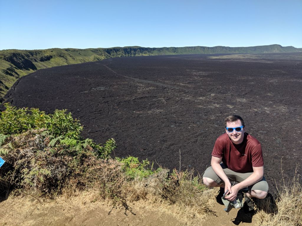
We climbed one of the six volcanoes that make up Isla Isabela (Sierra Negra) on a long, dusty day hike that brought us to the rim of the caldera, and to the lava flows from eruptions in 2018, 2005, and 1950. The caldera is about 45 km in circumference and the scale is just mind-boggling. Remember – this is one of six that make up this island! From the 1200m summit, we could see the other five volcanoes peeking up above the clouds. If you look carefully in the photos and video below you should be able to spot a few of them.
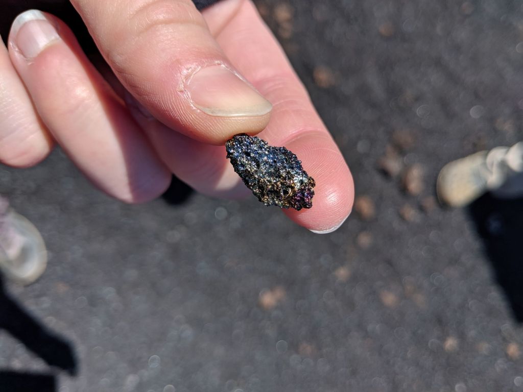
I was really excited to walk on and touch rocks that were only a year old.
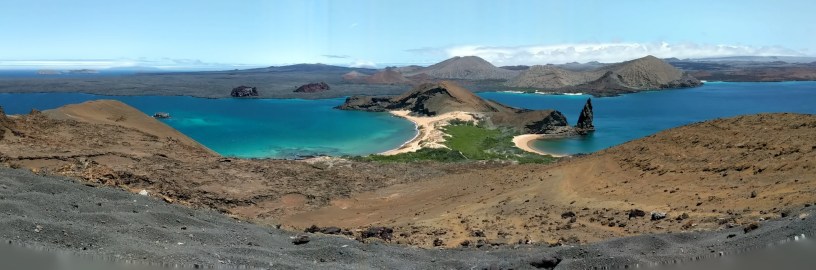
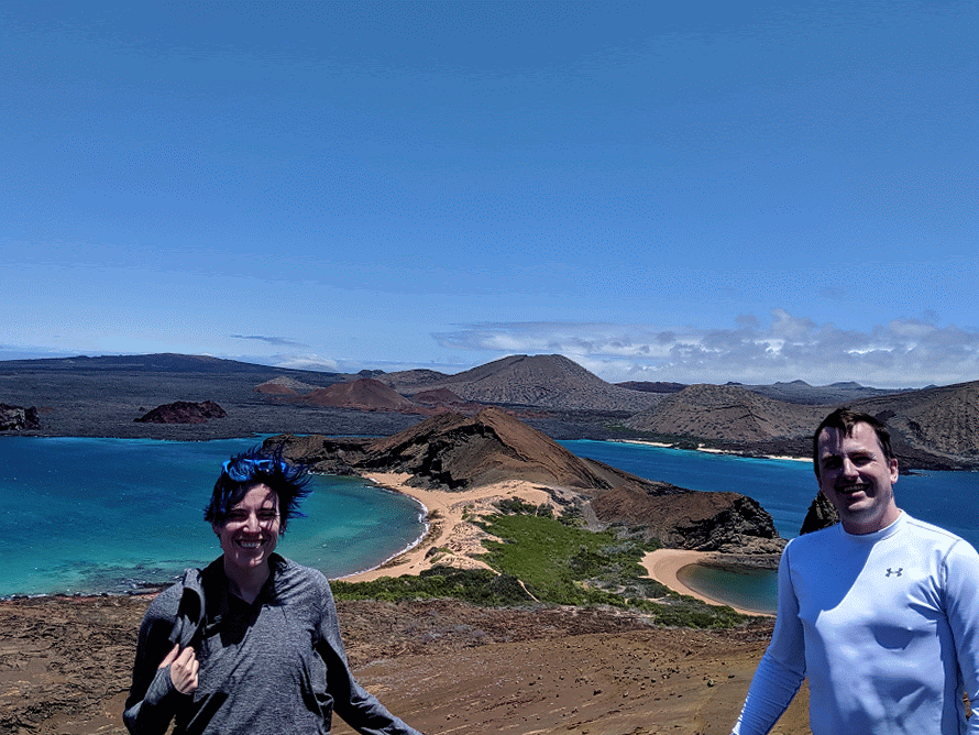
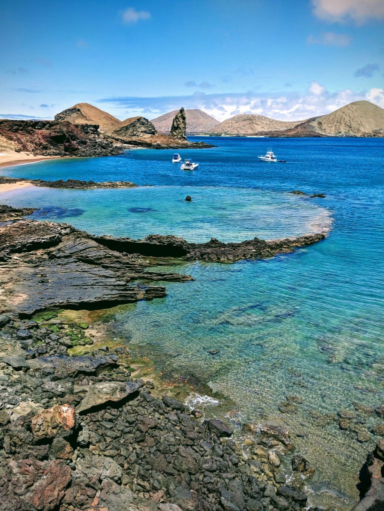
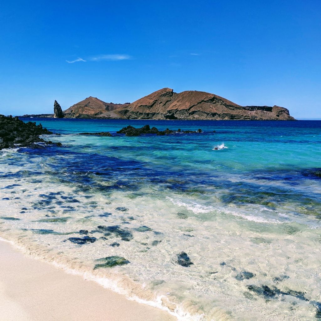
We took a day trip to Bartolome Island, a small volcanic islet off the coast of Isla Santiago. Bartolome’s volcano is extinct, and it has left behind some classic Galapagos landscapes of red, black and orange volcanic formations. It was also really windy up there.
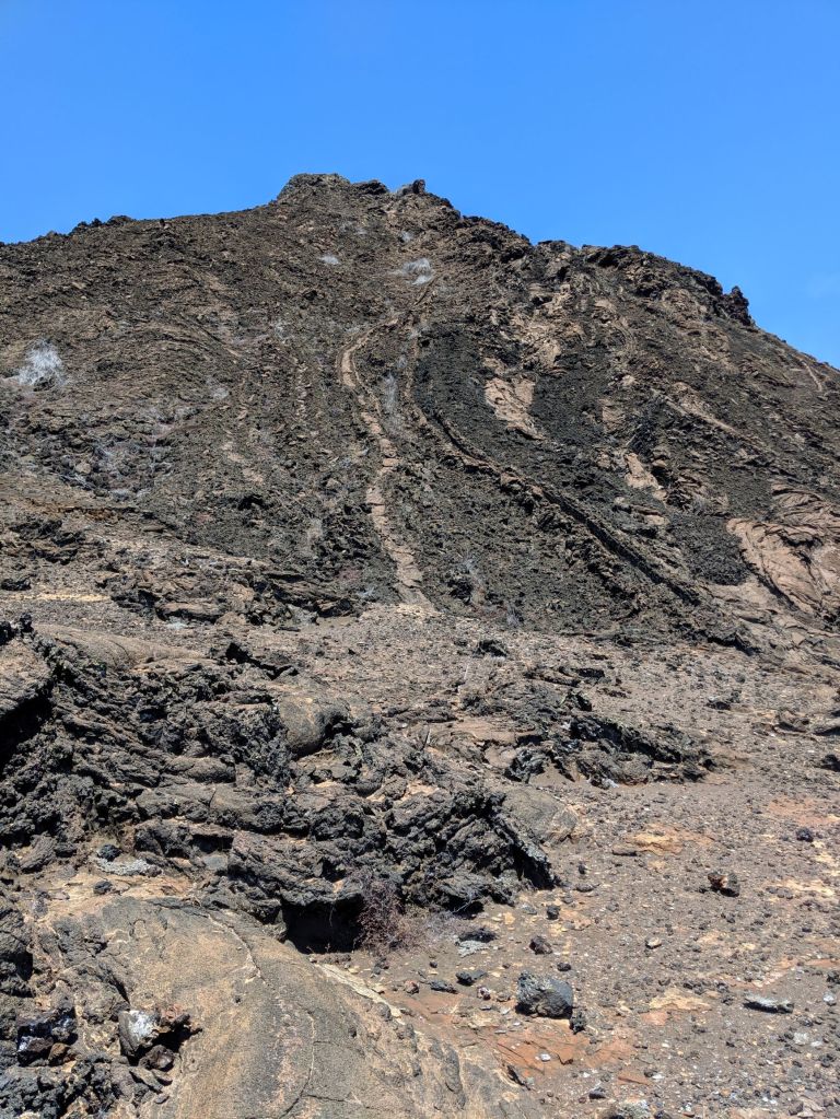
On Bartolome, we saw two types of basaltic lava, pahoehoe and a’a. These Hawaiian words for lava types have been adopted by geologists worldwide. Pahoehoe lava flows slowly, has a smooth, ropy texture, and typically forms thin layers between 20cm and 2m. A’a lava typically moves quickly, has rough, jagged and broken surfaces, and has thicker flows, from 2m to 10m in height.
Lava – mostly a’a 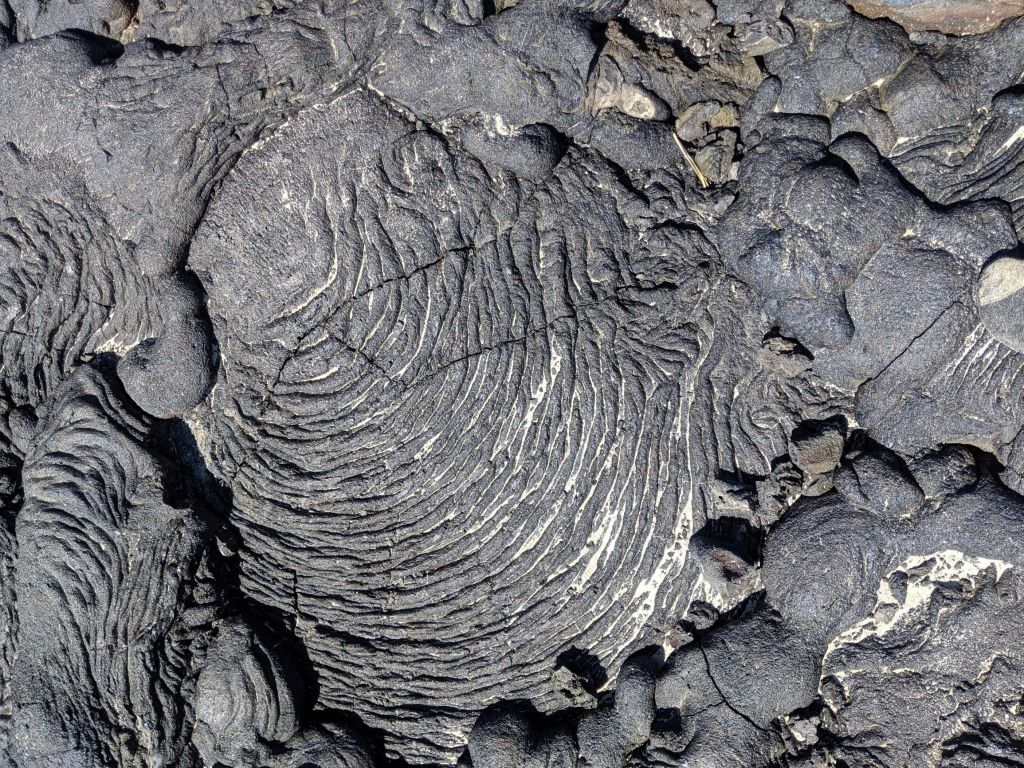
Lava – Pahoehoe
We did some snorkeling in James Bay on Isla Santiago with Pinnacle Rock on Isla Bartolome in the background. This was a simply stunning location!
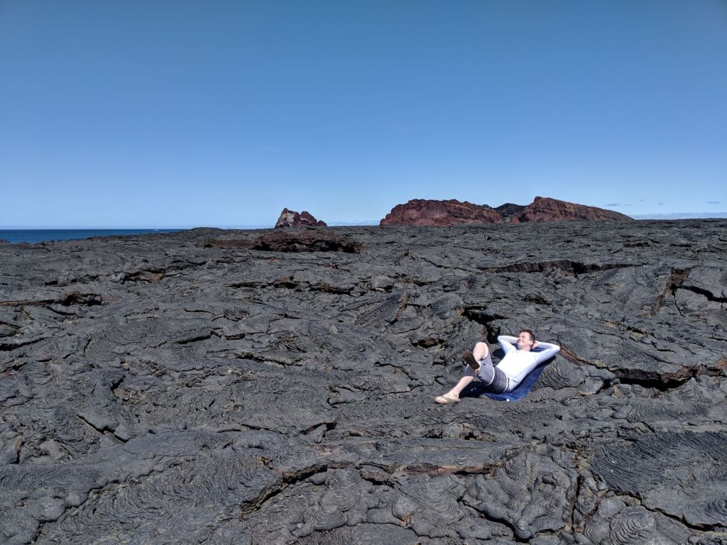
We also visited a fairly new lava flow on Isla Santiago. This flow was primarily pahoehoe (and therefore reasonably comfortable for lounging, as Bryn demonstrates below), and dated from around 1906. Early colonizer species were just starting to take hold here, and we saw a few lava lizards and some greenery starting to get a tentative toehold on the rocks.
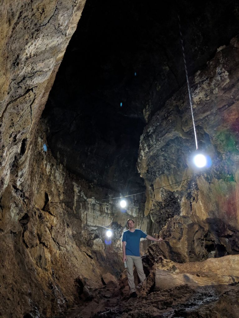
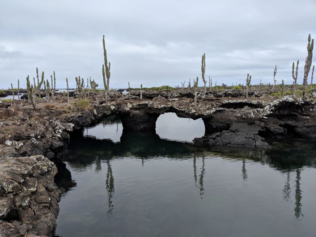
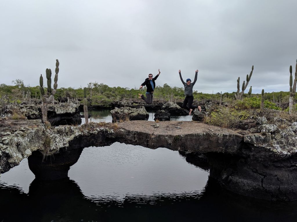
Another cool volcanic feature we visited were the lava tunnels on Santa Cruz. These tunnels are over 1km long, and were formed when the outer skin of a lava flow solidified on the outside while the molten rock continued to flow inside, eventually draining away and leaving a cavity. The Islands are riddled with these tunnels, but the ones near the town of Bellavista on Santa Cruz seem to be the largest.
The otherworldly landscape of the Los Tuneles snorkeling site (yes, where we saw all the blue-footed boobies we went on about in the ‘things we saw on land’ post) was formed by the collapse of a complex system of lava tubes that eventually flooded.
In addition to the wild geological situation, the larger islands have some fascinating microclimates dictated by both altitude and cardinal orientation. For example, on Santa Cruz, the arid northern lowlands were formed by tectonic uplift, and were previously lava flows on the ocean floor. North of the twin peaks in the centre of the island, the climate is hot and dry, and cacti, sandalwood, and other drought-tolerant, light-coloured trees and plants thrive. In the highlands surrounding the peaks, a narrow zone of scalesia cloud forest features a much cooler and wetter climate. Unfortunately, invasive blackberry and other introduced species threaten this landscape. Lower down the southern slopes, tropical plants and fruit are abundant, with orange, banana, papaya and others leaning languorously over the road. Oranges are actually native to the islands – both the fruit and the seeds float! On the south coast of Santa Cruz, the lowlands are a narrow band along the coast with a much damper climate than the northern side of the island. An impressive variety, given the island is only about 30km by 40km, with a high point at about 860m!
There are effectively two seasons in the archipelago: hot and drizzle. We were there during the “drizzle” season, which means more active wildlife and colder water, and occasional risk of getting drenched in the highlands!
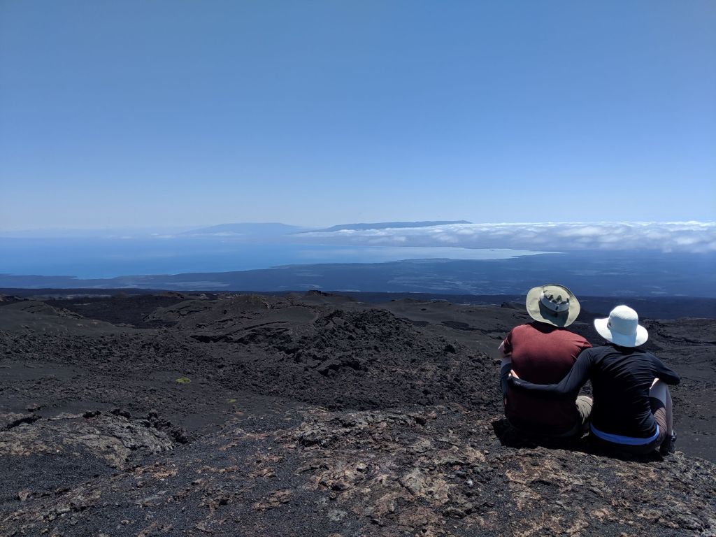
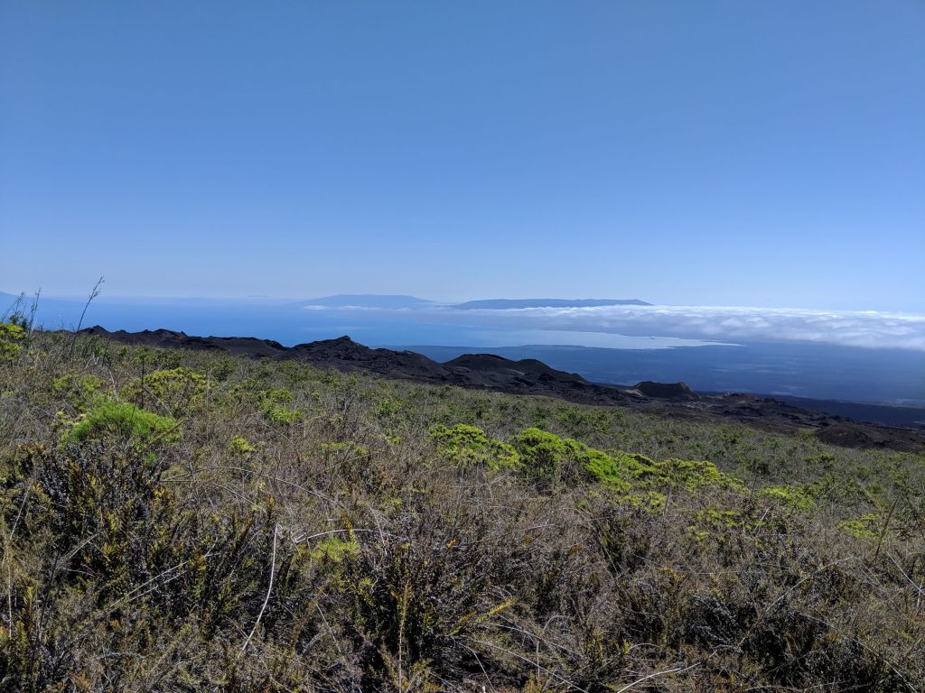
In closing, here are a few other scenic views we spotted while out and about, and a video illustrating the awesome power of the South Pacific swells.
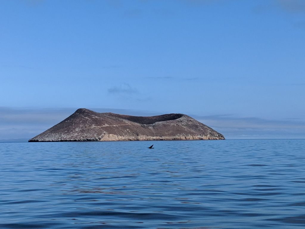
That picturesque volcanic cone is Daphne Major – we passed by here on our way to Bartolome.
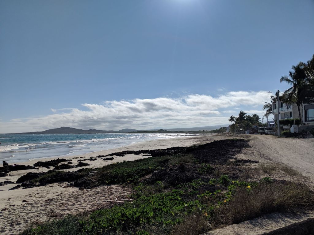
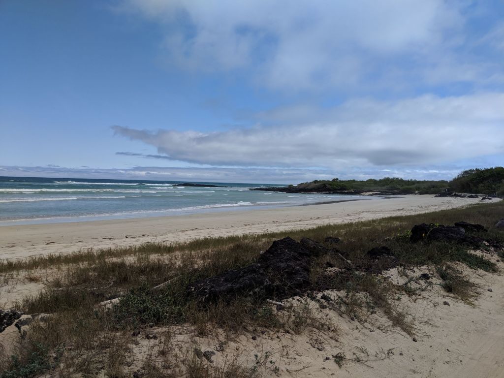
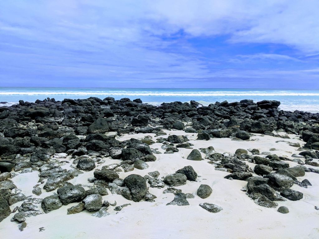
A couple of the many, many gorgeous beaches around the islands. Funnily enough, most of the beaches here are white “sand”, and not the eroded volcanic material that you might expect. That’s because the Islands are too young for erosion to have formed any substantial beaches of volcanic material. So the white sand beaches are all formed of shell and coral debris that washes up and gets caught on shore. We saw lots of beaches in the process of forming, where the white sand contrasts with the black volcanic rock to very picturesque effect.
This final video was taken on our day trip to Los Tuneles. We spent a lot of time on boats during this trip, mostly transiting to day trip sights and/or ferrying between islands, and we experienced some fairly rough seas. The islands’ location at the confluence of various major Pacific currents makes sea conditions…interesting. If you go due south from where this video was taken, the first land you’ll hit is Antarctica…and we’re not far from the equator here. Additionally, the configuration of the archipelago results in wind tunnel effects and some complex sea conditions as you sail in and out of the lee of various islands.
